Where to Hike in Winter in the UK – National Parks
)
With the colder months here for the foreseeable future, you may need to put on an extra layer before you set off on a hike across country or coast. There are many adventurous, relaxing, as well as challenging winter walks all over the UK, and this guide will inform you on where to hike in winter in the UK.
- Snowdonia National Park
- Northumberland National Park
- Northumberland Coastline
- Yorkshire Dales National Park
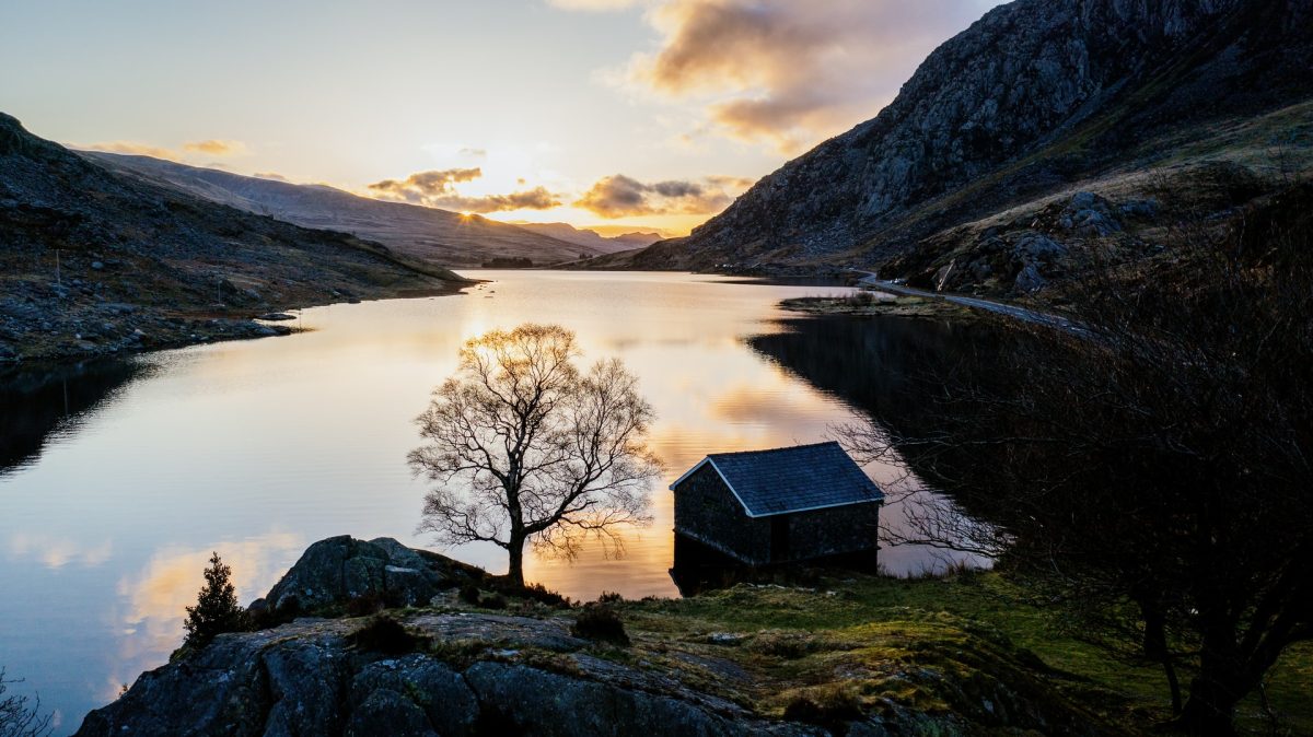
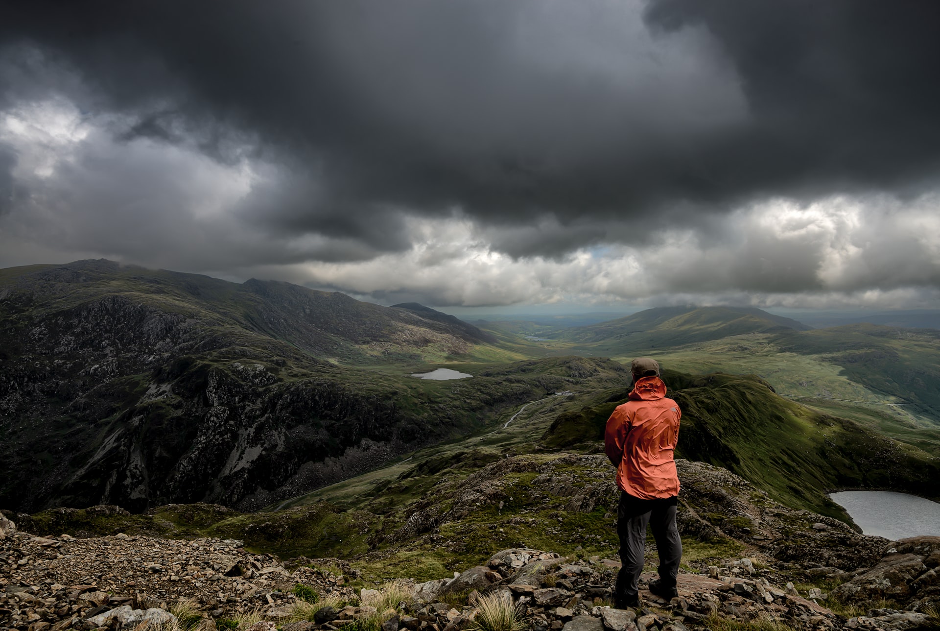
1. Snowdonia National Park
Wales is well-known for its scenic valley and mountain views, and the Snowdonia National Park harmoniously combines beautiful views with its many hiking trails that are suitable both for the energetic type of walker and those who like to take it steady.
Gelert’s Grave Walk – Craflwyn and Beddgelert
Difficulty: Easy
Length: 1 mile
Time: 1 hour
The walk to Gelert’s grave is the easiest hike on our list for Snowdonia National Park, with the trail only being 1 mile long, the journey could be completed as quickly as 40 to 60 minutes.
This walk is a 40 minute drive north from our Snowdon based property Tan Llan in Llanelltyd near Dolgellau. Although this may seem a way out from Tan Llan, the ease of this hike even in the winter months, allows for all hiking abilities and ages, from families with children to retirees looking for an easy-going walk. Gelert’s grave could even be integrated into one of our later entries to create a full day of winter hiking.
Gelert’s grave is Beddgelert’s most famous feature; according to the Beddgelert Tourism Association:
the stone monument in the field marks the resting place of ‘Gelert’, the faithful hound of the medieval Welsh Prince Llewelyn the Great.
The trail begins at the bridge crossing the River Glaslyn where a dedicated footpath will lead you past the church of St Mary. Following the footpath left and across the field, you will then find the stone monument, Gelert’s grave. Continuing your journey by following signs for Beudy Buarth Gwyn, you will come across the bronze cast of Gelert, and the path will then lead you back to the river.
When making your way back to the start of the trail, you will see Ynys Dol-leian, a wooden island in the river that represents the presence of an ancient Chrisitan community in Beddgelert. You will also find the old railway bridge that closed in the 1990s, and if you continue to follow the footpath you will see the spectacular views of Aberglaslyn gorge.
Upon reaching the end of the trail you will find a commemorative picnic area dedicated to Alfred Bestall who illustrated the famous Rupert the Bear cartoons and who lived in a nearby cottage.
Although the hike to Gelert’s grave is relatively short compared to others on this list, there are still many interesting and beautiful sights to see as you take in the crisp winter air of Beddgelert.
Cwm Idwal Walk – Carneddau and Glyderau
Difficulty: Moderate
Length: 3 miles
Time: 3 hours
The Cwm Idwal walk may be a 1 hour drive from Tan Llan, but this hiking route is just beyond Gelert’s grave, so could easily be integrated into your day of winter hiking. This hiking trail is a step up in difficulty from the Gelert’s grave walk, but the picturesque mountain views, especially in the winter months, are more than worth the chilly 3 hour walk.
The hike begins at the Ogwen Cottage Ranger Base where the Snowdonia National Park Visitor Centre is located. From here you will see steps ascending steeply to the mountain gate, continue over this and to the bridge where you will begin to see the peaks of Y Garn, with Afon Idwal in the foreground.
When you continue to follow the winding path, you will come across a fork in the road, follow this right along the stone path. You will then arrive at the beautiful Llyn Idwal lake, you can choose to walk around the lake in any direction, but following the path left will take you to a gate and wall which prevents wildlife from grazing on the upland vegetation that the nature reserve is helping to grow.
The hike will then begin to ascend again as you climb over rock debris left behind by glaciers nearly 10,000 years ago – thankfully it will not be nearly as cold as it was back then when you visit, but still very cold nonetheless! Next you will arrive at Idwal Slabs, a mountaineering training ground. At this point you can either take the path right and follow it downwards or take the rough path upwards towards the base of the cliffs, this should only be taken by competent hillwalkers as the terrain, especially in the winter months, can be very hazardous.
Looking to your left you will see the ‘Devil’s Kitchen’ which lovingly refers to the sheer cliffs of Cwm Idwal. The path will now gradually decline as you head back towards the Llyn Idwal, the lake has been known to freeze over, so if you are there to see this, take in the snowy winter wonderland.
You can then take the same path you took up back down to your initial starting point and your winter hike through the mountains will be complete. Remember, during the winter months, Cwm Idwal can feel very cold, even if there is sun out, so wear the right protective clothing and walking shoes in order to fully enjoy the experience.
Dolmelynllyn Estate Walk – South Snowdonia
Difficulty: Moderate
Length: 4 miles
Time: 4 hours
Our final where to hike in winter destination is the Dolmelynllyn Estate walk which is only a 10 minute drive away from our Tan Llan property, so this is the perfect long winter hike as you can quickly get back to our cosy country house for a drink of hot chocolate and warm yourself by the fire.
The Dolmelynllyn Estate walk is another long walk like the Cwm Idwal walk but is different in that although it is longer, the walk itself is mostly flat so may not be as tiring to new or beginner hikers. This winter hike will take you past enchanting waterfalls, historical sites, and National Nature Reserves, so there is something for everyone with this nearby hike.
The walk starts by the village hall in Ganllwyd where you will follow the road to the wayfinding sign pointing towards a bridge. As you cross the bridge and head right, you will see Rhaeadr Ddu, or Black Falls, which is made up of two separate mesmerising waterfalls.
Following the path around and heading right you can then make your way through the woodland where you will see a conifer plantation. After crossing an oak bridge, wayfinders will take you past the 19th-century gold workings. Along the way, make sure you keep an eye out for the stamping mill, barracks, and powder huts as the path leads you down towards the ruined cottage of Berthlwyd.
After walking downhill and crossing the stile across the road head into another woodland area and following the wayfinders in the woods you will soon find the Merionnydd National Trust base. A short walk will then take you past the Tyn-y-Groes Hotel and along the River Mawddach and the Tyn-y-Groes bridge. You will then arrive back at your starting point by the village hall.
There is a great deal of history to take in on this winter hike, from the inspirational waterfalls that artists and poets have come to for centuries, and the fascinating abandoned gold mines, and the ease of this long walk ensures that all can enjoy the history and awe.
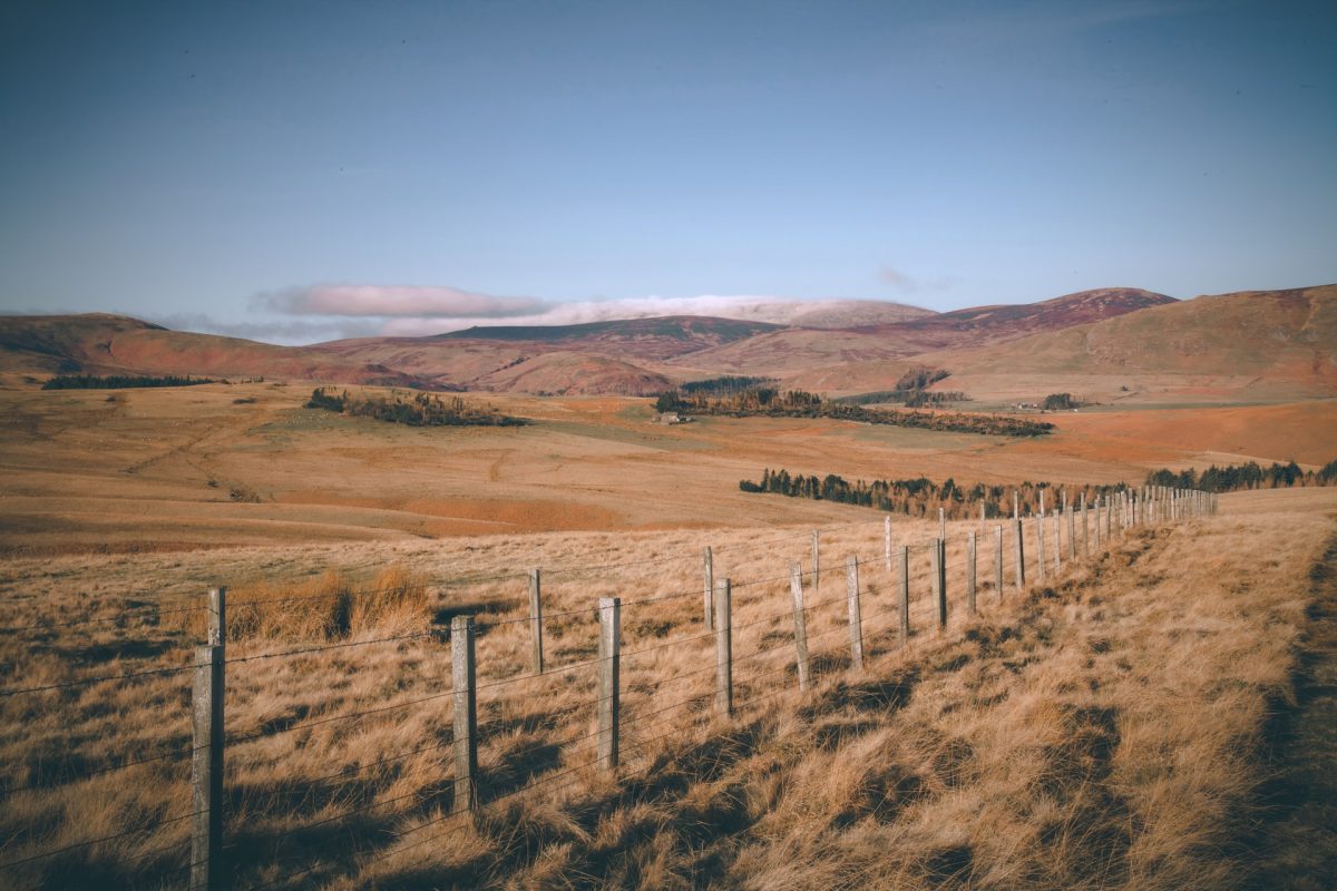
2. Northumberland National Park
Next, we are moving away from Snowdonia to the northernmost national park. The Northumberland National Park is statistically the least populated and is also the least visited national park in the UK, so it can boast a truly rural winter hiking experience. And if you are looking for a snowy winter hike the Northumberland National Park is the best place to visit.
Falstone Circular Walk – North Tyne and Redesdale
Difficulty: Easy
Length: 2 miles
Time: 1.5 hours
The Falstone Circular Walk is an hour and a half drive from our Northumberland properties in Craster, Alnwick. Despite the long drive, this hike is in the quaint little village of Falstone, and the walk consists of an easy ramble past rivers and over old, abandoned railway tracks. This hike is accessible to all types of hikers all year round, and with it only being 2 miles long, it spares enough time to visit the local tearoom for a well-deserved seasonal treat.
The hike begins at the Falstone Old School car park, turn left out of the junction and head towards the railway arch. Once cleared, follow the path left up to the railway line itself, and from here you will see the top of Kielder Dam. Following the path through the forestry, you will reach a clearing where you will find Hawkhope Farm.
Once you have reached this point, cross over the railway and the Hawkhope Burn and turn left again to walk towards the farm. Along the way you will pass fenced off areas, these areas are part of a conservation project that is carried out by local volunteers.
Next you will follow the path and hike through the field where you will then head in the direction of the River North Tyne. Once you reach the tennis courts, the route now starts to meander back to the start point. Along your journey back, you will come across the Stell sculpture, and once you cross the stone bridge, you will be back at the Falstone Tea Rooms ready for a nice cup of tea after taking in the wintery sights at the charming village of Falstone.
The Lordenshaws Loop – Coquetdale
Difficulty: Moderate
Length: 3 miles
Time: 1.5 hours
Lordenshaws is the historical site of what remains of an Iron Age hillfort and Bronze Age burial mounds. This sublime icy landscape will take you back to another age in a matter of hours, and with the Lordenshaws Loop being only a 40 minute drive away from our coastal properties in Craster, Alnwick, it is an unmissable winter hike.
You will begin the walk in the Lordenshaws car park, and if there is no parking available Simonside car park is a 20 minute walk away. From the Lordenshaws car park, follow the path heading up the hill, and after exploring the grassy or perhaps snowy hillside, you will see the entrance to the hillfort as marked by three large stones.
When you have finished navigating the Lordenshaws burial mounds and hillfort, you can begin to walk downhill and turn left on the path which will take you through a field of heather which grows all year round. Once you have walked through the heather you will reach a gate, go through this and hike upwards towards the fence. Upon reaching the fence you will find another gate, cross this and continue walking, ensuring to keep the fence to your right. Continue through the field until you reach the farm gate and turn left.
Moving forward, turn down another farm track waymarked as Whittondean/Lordenshaws and keep the farm buildings on your left as your hike progresses. Once you are past the farmhouses, the terrain will move downhill, and as the path bears left, head right and continue to the gate ahead.
Now you have gone through the gate, the path will now meander uphill where you will find a gap in the stone wall, go through this and turn right to follow the path. As you keep the fort positioned to your right, you will soon reach a junction that will take you out by the Lordenshaws car park, and the Lordenshaws Loop will be complete. Now imagine being in the Bronze Age and not having any modern clothes to keep you warm on your winter hike! This walk will transport you to a time long forgotten by us.
Reaveley Farm Family Walk – The Cheviots
Difficulty: Easy
Length: 2.5 miles
Time: 2 hours
Sometimes choosing where to hike in winter is not about the challenge, it can simply be about getting some much needed brisk fresh air, and the Reaveley Farm Family Walk is a gentle walk suitable for most hiking abilities. This hike is also a 40 minute drive from our Northumberland properties, however, with The Cheviots being so expansive and remote, there are many different hikes for the whole group to take part in, making the journey worthwhile.
The Reaveley Farm Family Walk starts at Ingram Café, where lots of delicious food and drinks can bought as pre-hike motivation, or as a post-hike treat. In the winter months, the café does work on reduced hours, opening from 11am – 4pm November to March. After visiting the café, head towards the Woodland Walk until you reach the gate. Once through, turn right and cross the bridge that leads downhill to the valley.
Soon you will reach a bridge, cross this and follow the wayfinding signs for Reaveley and this will bring you to a tarmac road. Follow this left past Reaveley Cottage and when you reach beyond all the farmhouses, turn left at the junction and continue towards the River Breamish. And once you have reached the junction, turn right and the road will take you back to Ingram Café.
This is a very simple winter hike, however, it provides an excuse to get the whole group out and about for some winter exercise, and the Ingram Café is a bonus too.
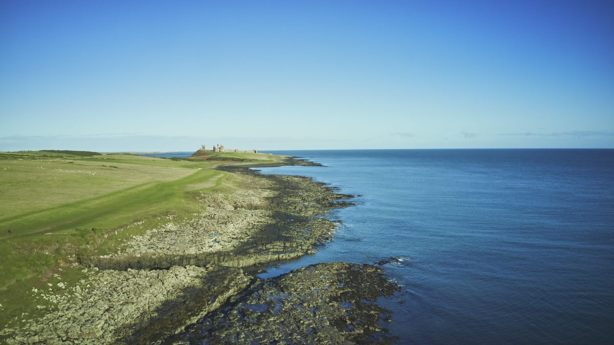
3. Northumberland Coastline
Northumberland may be infamous for its expansive and sublime national park, however, it is equally as famous for its picturesque coastline. The Northumberland coastline is 62 miles of scenic hiking trails and tranquil beaches and is right on the doorstep of all our Northumberland properties in Craster, Alnwick.
Coastal Walk – Craster to Low Newton
Difficulty: Moderate
Length: 7 miles
Time: 3 hours
As we already mentioned, the benefits of staying at one of our three Northumberland properties, whether that is Craster Reach, Middlerigg, or Rock Lobster, means you will only be a few minutes’ walk away from the start of this coastal walk. The northern coast can be very windy even in the summer months, so ensure you wear the right clothing as the winter sea breeze can get very cold.
Starting the walk at Craster you will then pass the harbour in the direction of Dunstanburgh Castle where the path will then take you through fields of farmland to your left and the coastline on your right. Your journey can incorporate a visit to Dunstanburgh Castle, and National Trust members can visit free of charge.
After passing the castle, turn left around the base of the building and with the golf course on your left head downwards towards the beach. The route will now guide you to the end of Embleton Bay and past the Embleton Burn where if you are feeling brave, you could dip your feet into the water – although it will be very cold in the winter!
As you head towards Newton Harbour, take the time to explore Northumberland’s coastal wildlife and vegetation and see what curiosities you can find. Once you are done exploring, hike up from the beach to Low Newton’s town square and here you will find a National Trust information point and lots of lovely shops and restaurants for you to have a relax from your winter hike.
After resting in Low Newton, you can then begin to make your way to the path behind the square which will bring you out by the sand dunes and through a woodland walk. Following this path will guide you to a lookout that faces out over the water of Newton Pool nature reserve. As you continue along the path you will head towards Dunstan Steads where you will pass the golf course again and you can start heading back towards Craster to finish the journey.
After completing your journey along the Northumberland coastal walk, why not warm yourself up by visiting one of the local restaurants for some freshly caught seafood.
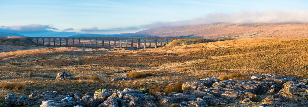
4. Yorkshire Dales National Park
Finally, we move on to the last of our recommendations of where to hike in winter in the UK, and that is in the Yorkshire Dales National Park. The Yorkshire Dales are known for making a lasting impression on visitors, such as famous author Thomas Hardy who often used Yorkshire as the backdrop of his novels. It is an impressive place to visit when staying in our Yorkshire property Oughtershaw Hall in Buckden, Skipton.
Great Whernside – Kettlewell
Difficulty: Moderate
Length: 7 miles
Time: 4 hours
Great Whernside is a challenging winter walk as it traverses mountain peaks and the inevitable snowfall they have during the winter months. Yet it is very tempting to attempt this winter hike when the great Whernside is a mere 20 minute drive away from our Yorkshire property.
There is a large pay and display car park in Kettlewell, so after parking up here you can make your way into the village of Kettlewell and head towards the Dower Gill Beck bridge. However, do not cross this bridge but turn right and follow the path so the river is on your left as you pass the cottages leading to Providence Pot. This is a fairly steep climb but once you reach Providence Pot continue following the path out of the valley towards Hag Dyke Farm.
Upon reaching Hag Dyke Farm, the path may seem unclear in winter weather, but take your time and follow the crags to begin the climb up the rocky terrain. From here on, the path is marked by wayfinders which will guide you to the summit of Great Whernside where the views are spectacular as you look over all of Skipton. You can rest here and take in all of the Yorkshire Dales’ natural winter beauty.
As you descend the mountain, follow the path of the Yorkshire Dales National Park boundary which will lead you to a gate that brings you out at the main road. After following the road to Starbotton Lane, turn left and make the leisurely walk back to Kettlewell, and why not stop for some afternoon tea at The Cottage Tea Room as a treat for climbing the Great Whernside’s freezing mountain peaks.
Aysgarth Falls – Wensleydale
Difficulty: Easy
Length: 3 miles
Time: 1.5 hours
Wensleydale is famously known for its delicious namesake cheese, but did you know it is also well-known for its waterfalls. This beautiful, tranquil hike is only a 20 minute drive away from our property, so what better excuse could there be to visit Aysgarth Falls, even in winter.
Although this route is already relatively short compared to others on this list, the route we are about to describe is the longest possible route of 4, so this winter hike could be made even easier if you are feeling a little too chilly.
The hike begins at the car park where the Yorkshire Dales National Park visitor centre can also be found. From here, cross the main road to Freeholders’ Wood which has fantastic views of Middle Falls. After taking in this view, you can either make your way down the flight of steps to the Lower Falls or follow the path downwards.
The longest part of the walk takes place after viewing the waterfalls. Follow the black wayfinding signs out of the woods and into the fields, this route will take you through private farmland, past the picturesque ground of Hollins House, and over the old railway line.
As you follow the signs, the path will eventually bring you around full circle back to Freeholders’ Wood and into the car park where you can gain more information on Aysgarth Falls from the visitor centre.

Malham Landscape Trail – Skipton
Difficulty: Moderate
Length: 4.5 miles
Time: 3 hours
Our final winter hike is through the peaceful landscape of Malham which is just a 45 minute drive from Oughtershaw Hall, but the landmarks along this walk are worth the drive.
The Malham Landscape Trail hike starts again at a visitor centre of the Yorkshire Dales National Park in Malham. Follow the main road until reaching the bridge on the right that crosses over the River Malham Beck. Continue along the dedicated woodland path along the River Gordale Beck that guides you to the beautiful waterfall, Janet’s Foss, lovingly named after the queen of the fairies.
After taking in the sights of the enchanting waterfall, the path will continue onwards with the River Gordale beck still staying on your right as you approach Gordale Bridge. After crossing the trail will take you to Gordale Scar, another beautiful waterfall that has for centuries has cut deeper and deeper into the rock to create a sublime gorge.
Double back on yourself and head back over Gordale Bridge, but instead of going back in the same direction, take the over path right and this will begin your loop back. After a long but straight walk, you will eventually reach Malham Cove. This towering limestone cliff-face is 80 metres tall and 300 metres wide, so the grandeur of the scene is rather breath-taking and is a good resting stop to take in the scale of the full view.
Next is just a short walk through woodland areas as you travel back to the car park via the main road with the River Malham Beck on your left, and soon enough your hike through the Malham Landscape trail will be finished.

There are a plethora of places to hike in winter in the UK, especially in the national parks surrounding our properties in Snowdonia, Northumberland, and Yorkshire. These hikes are varying in difficulty, ensuring that all guests can partake in the thrill that is a hike through the snow and chill of winter.
For further information on our properties and their availability all year round, not just for winter, contact us on 01829 830 388 or email at info@catchthebreeze.co.uk.
Back to archive
Catching the 2022 Breeze
Feb 2022Welcome to Catch the Breeze Retreats’ first of many blogs, filled to the brim with all our news, updates, and…
What to do in Snowdonia When it Rains
Mar 2022March – a month that is often filled with unpredictable and transitional weather as we slowly move into Spring, the…

Welcoming Spring at Catch the Breeze Retreats
Apr 2022As we settle into the Spring season, the weather is getting warmer, the evenings are getting blissfully longer, and the…